Anywho, the park, named Kenneth Hahn State Recreation Area, is a hidden treasure, right in the middle of what seems like smog-and-traffic-and-ghetto-hell. But seriously, it's a truly beautiful place just off La Cienega Blvd, between Slauson and Rodeo Avenues. I used to pass this park weekly on my way from home (Redondo Beach, CA) to school (USC) or to my internship (National Association of Social Workers, CA Chapter, Southern CA office, which used to be next door to the CA Automotive Museum, on the Miracle Mile on Wilshire Blvd. Great office, great area, but I digress...). Once, when I was still in grad school, I drove up through it, and I remember being surprised by its size and by how many people where there doing what appeared to be fishing in the little lake there. Back then I didn't get out of the car, just because I was driving through. This time, I parked and did some exploring.
The book says that this hike is 2 miles, that it'll take me about 1.25 hours to complete, and that the scenery will include Sagebrush, salamanders, California quail, jackrabbits, and LA city views. It also says that the park is named for the legendary Kenneth Hahn, former mayor of LA and father of a local political dynasty that includes San Pedro's own Janice Hahn, City Council member and general upwardly mobile politician (she's running for Lieutenant Governor of California presently. I hope she doesn't win, but that's just me), amongst others. Kenneth Hahn is one of my early heroes, and this place was a big deal to him, as well it should be. This place has everything! Baseball diamond, picnic tables everywhere you look, basketball court, playgrounds, wide open, grass-filled spaces, hiking trails, and a lake that's stocked with trout and catfish (limit is 5 per fisherman per day). There are restrooms and trash bins everywhere, and parking for the whole world. It's truly a park. Like, I could take my whole family here for a day and never run out of things to do.
But enough about the park. So, I arrived and drove to the middle parking lot to park. I did this mostly because I figured I could get anywhere if I parked in the middle, and because I was finishing my morning coffee and needed a restroom. So I parked near a restroom and the volleyball court (did I mention there's a volleyball court, too?), and got out. Here's the parking lot:

The book says the trailhead for the Walk for Health trail (which opened in 2003) is back by the entrance to the park. I walked back there (after setting the Endomondo app for hiking/fitness walking and pressing "GO") past two different playgrounds, a few guys picking up trash, and the basketball court, and started up what I figured was the trailhead. I thought it was the trailhead because it looked like this:
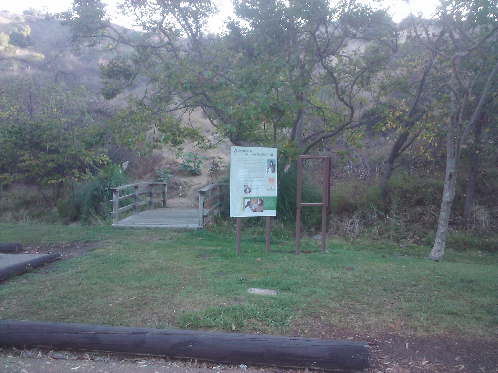
Yeah, I was wrong. The trail I was on looked like this:
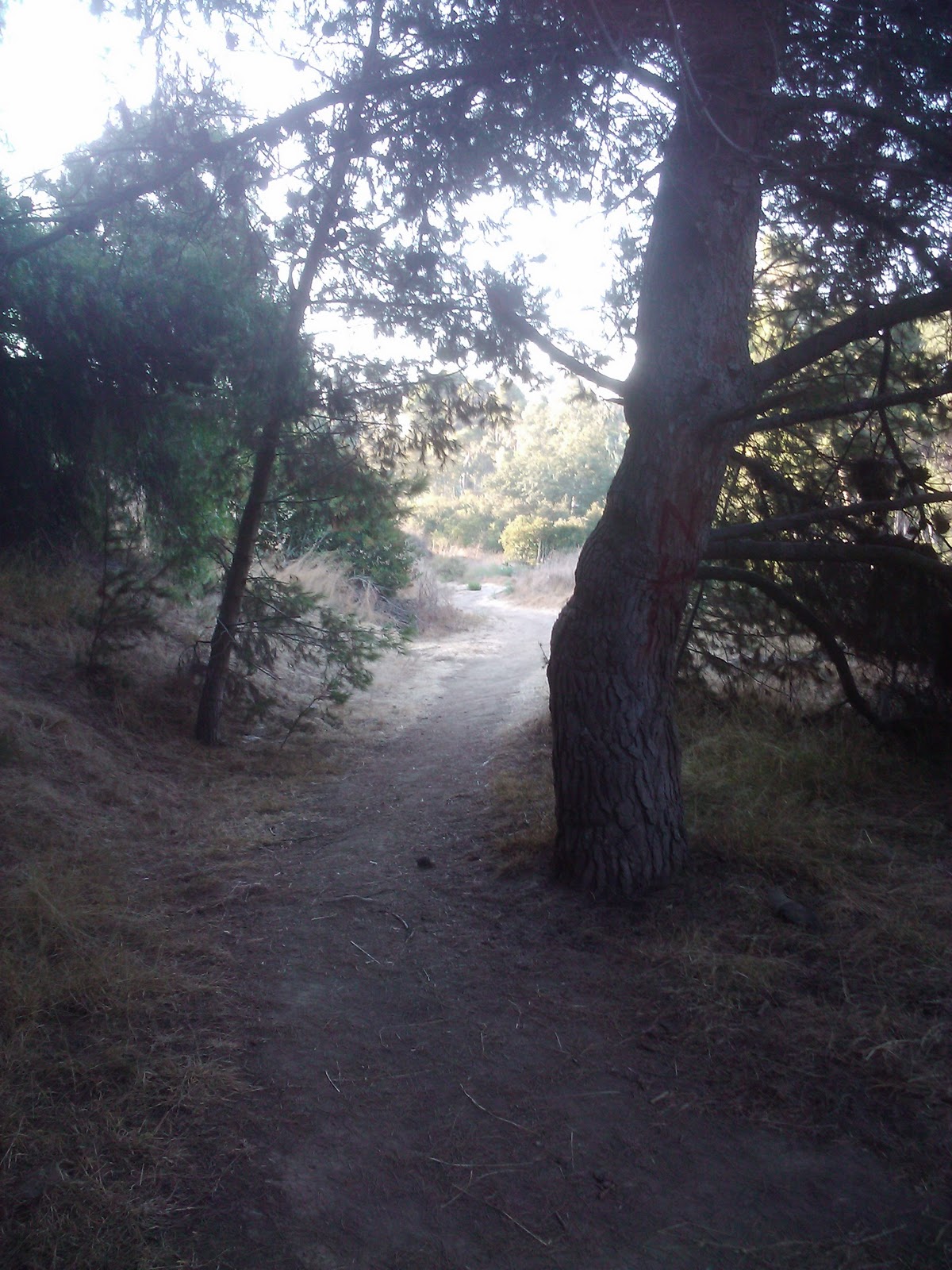
Nice, huh? Right, but about 300 yards later, that trail joined up with this one:

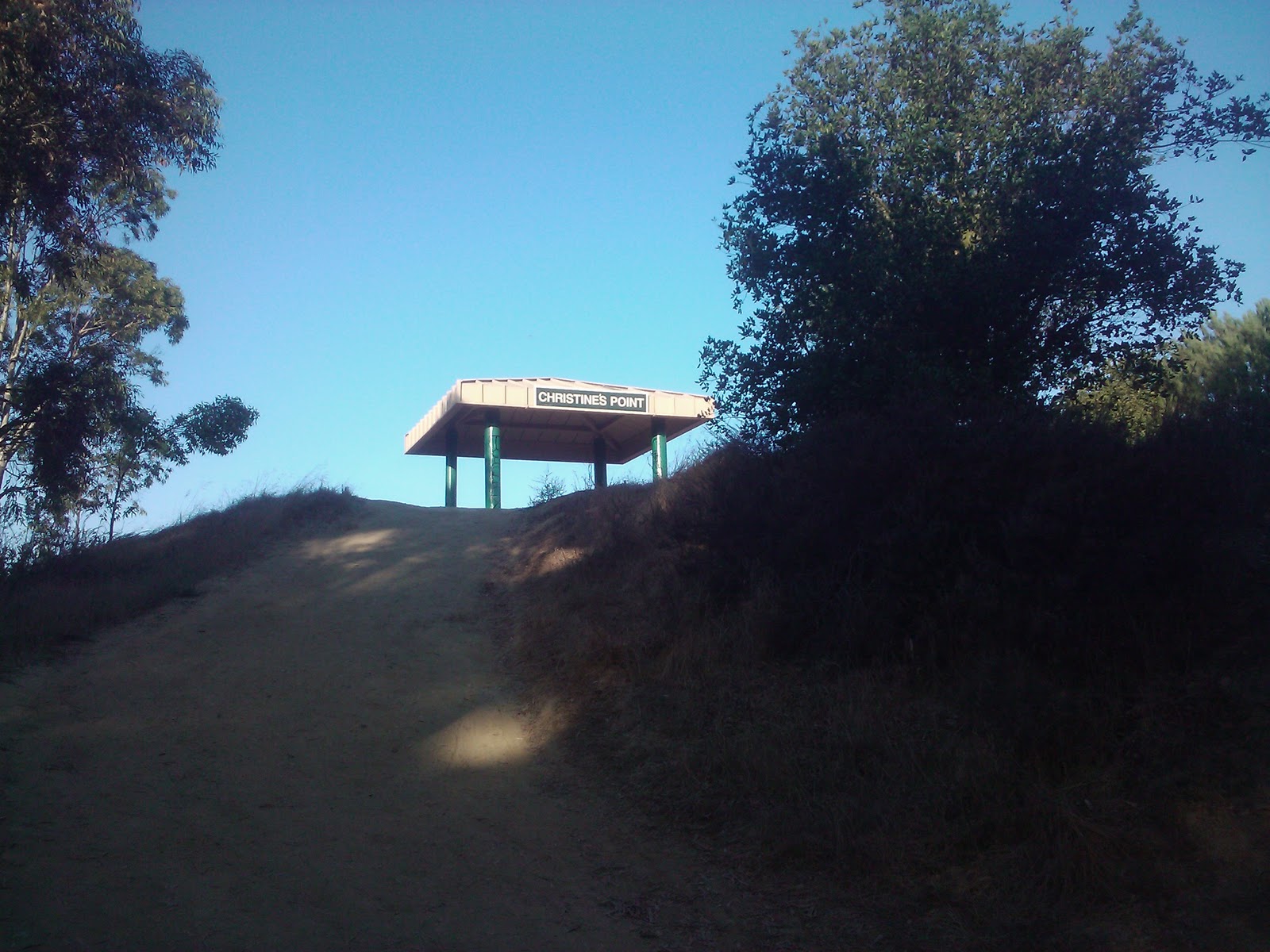
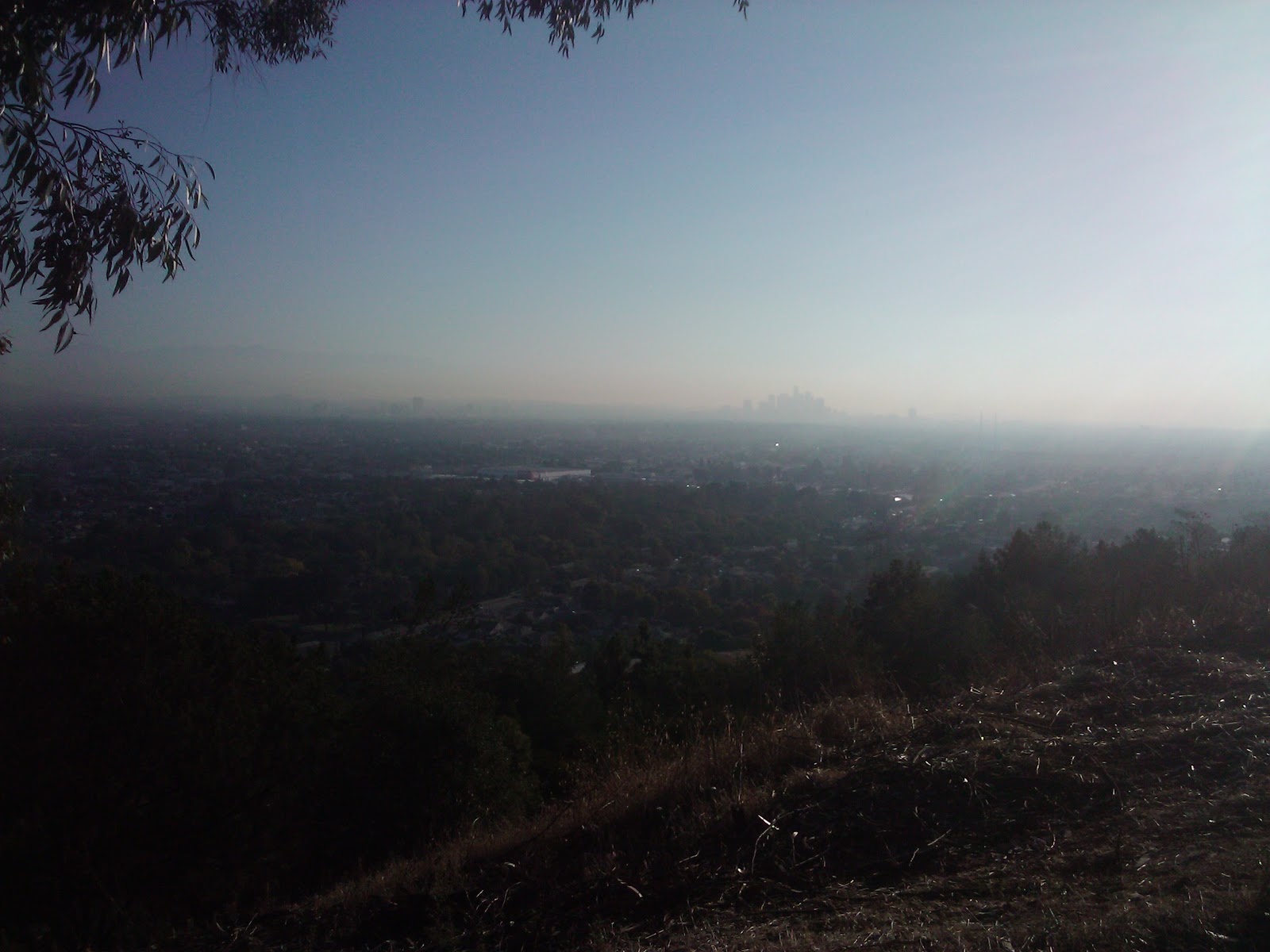
Woops. First mistake. No worries, though. Now I was on the right path. I hung a right and continued up this new path, and was promptly greeted by a little hill. Fine. I huffed and puffed up the hill, and then was greeted by another little hill. I passed sagebrush, pine trees, and a few other walkers, and eventually reached a little landing where I could go left towards a little pagoda that said it was called "Christine's Point", or I could go right, onto the rest of the trail. Or, I could just stay there, put my arms over my head, and try catching my breath while also catching a glimpse of a stunning view of greater Los Angeles.
I chose all three. Here's the view up to the pagoda:
Lesson Learned: Did you know that water is filtered through dirt and flora/fauna? Better your water should run down a hill and be absorbed by it and eventually find its way to stream and the Ballona wetlands than falling on the roads and sidewalks, getting polluted by horrible car-and-trash-things, and then run through the gutters to the Ballona Wetlands. I did not know this. Now I do. Thanks, Christine!
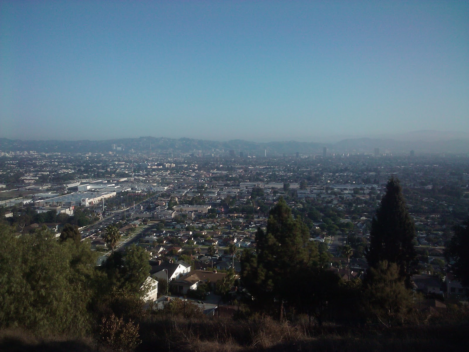
Off I went, back down the hill and to a little lookout point, where I could see, truly, the city in its entirety. It was a little overcast and smoggy this morning, but nevertheless: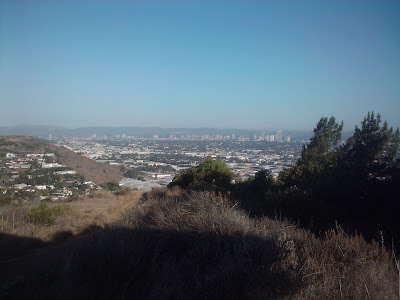
There's Century City and Santa Monica in the distance, and Ladera Heights in the foreground, along with some sagebrush in the fore-foreground.
Onward I trudged. I kept to the Walk for Health route, even though there was another trail marked "City View Trail" that looked interesting. I passed one sign that talked about staying hydrated, which I appreciated but did not heed. I brought nothing with me except my phone and my keys. Stupid.
Lesson Learned: Bring a backpack with water, phone, ID, and whatever else I need.
The Hydration sign also told me that the Prickly Pear, which grows in abundance here, stays hydrated by holding rain water in its "pads." It had a picture of the Prickly Pear plant, which made me think, "Cactus." It also made me wonder what the difference is between a cactus plant and a Prickly Pear plant.
Lesson Learned: Answer? Nothing. A Prickly Pear IS a cactus. I had no idea.
So, with that lesson learned, and about a quarter of the route walked, I realized I hadn't seen any of this famous Prickly Pear plant as yet. I looked around, sure I had missed something. Nope. Birds, brush, trees, trail. No Prickly Pear. Hrmmm.
I pressed on and continued looking for cactus. I walked up a bit of a hill to another pagoda on a sort of landing called "Autumn's Peak." It looked like this:


I kept on the trail and soon hit another pagoda, this one titled, "Michael and Emilia's Inspiration Point." Here's the pagoda:


And found some Prickly Pear! At last! It literally cascaded down the hillside, but I had to walk to the other side of the hill to finally see it.

Yeah, neither could I, really, so I took this next picture, too.

But before I do, I've moved significantly along in my trail journey, and I'd like to show you what the park looks like now that I have:

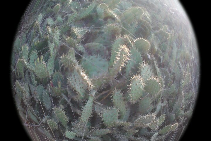
But I DID see me some more Prickly Pear! I was so excited it was so close to me, I busted out the new "FX Camera" app on my phone and took this with the "toy camera" part of the app:

I took a little moment at this point to get all obsess-y about the new FX Camera. There was a change in the trail here, too. It got skinnier. More Prickly Pear, skinny trail, some people (everyone was nice except a Mexican man who was dressed in jeans, a red and white checked, long-sleeved collar-shirt, and a cowboy hat with a red bandana, and cowboy boots. He didn't say hi. But then again, he was jogging. I couldn't make that up if I tried.)
Anywho, I was playing with the phone and took this "Polandroid":

You know, like the end of the trail. It actually finished under a big power line and dumped me out onto a paved trail that looked like it was attached to some sort of country club/golf course/random park place. It was completely different from what I'd been walking through, and even though there were people all over walking through it, it scared me with its manicured-ness.
So I turned around.
The book said it was sort of a one-way deal. Go to the end, then turn around. Laura recommends going back the way you came. I, however, am not a fan of the walk-back-the-way-you-came method of hiking. It's boring. So, I found one of the other little trails I'd seen earlier, and took one that lead in a downward direction. It was significantly less up-kept than the one I'd been on. And while I was sure I'd slide down half of it at some point, my Reeboks held their ground. Even when the trail looked like this:

So, I crossed over to the grass in the park, and walked over to my car, where I ditched my hoodie. Then I walked over to the bridges-and-grass part of the park that leads to the lake. Here's a Polandroid from the first brook-bridge:


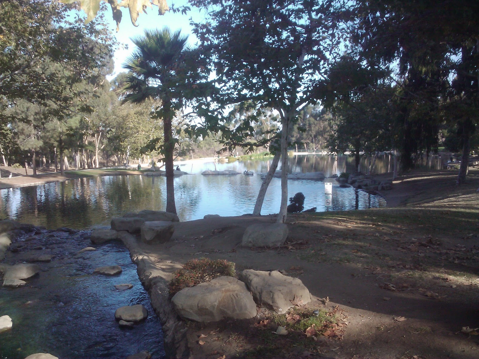
OK, it's not huge or anything, but it was hosting a few ducks, and some cranes, too. I'm fascinated by cranes, and I watched one of them not even flinch as a fisherman walked, pole in hand, about 2 feet near it on his way to another part of the lake. I mean, it didn't flinch. Neither did the fishing guy. I couldn't believe it. If only I'd had the camcorder on!


Anywho, that was the journey through the Kenneth Hahn State Park place. According to Endomondo, and despite the book saying the hike was only 1.25 miles, I walked 4.16 miles at an average speed of 4.29mph, for a total of 58.13 minutes. And, according to the same app, I burned 601 calories on my journey. Woot!
This is a great park, and I'd love to bring my 10-year-old nephew back to see if we can grab a few fish out of the lake. Maybe I will some day. I also didn't see any salamanders, like the book said I would, but then again, I didn't look nearly as hard for them as I did for the Prickly Pear. My nephew, who is a Lizard King, may be able to scurry some up when he and I come back. So there, there's my purpose for returning to this treasure-in-the-city: Fishing and salamander hunting with the nephew. I'll put that on my To Do list....
Next week? Hike #02 in the book: Debs Park City View and Walnut Forest Trails. Will I see actual walnuts? (Or an actual forest?) Stay tuned....